Establishing and Surveying the Uintah Reservation
The Uintah Valley Reservation was set aside in 1861 by Abraham Lincoln. In 1864, it was formally legislated by Congress, and a treaty was signed in 1865 by a group of tribal leaders within the Utah Territory agreeing to move to the reservation. Ute signers included Tabby, Kanosh and others. The treaty, which was never ratified by Congress, included provisions for the survey and division of reservation lands into individual plots for tribal members willing to settle.
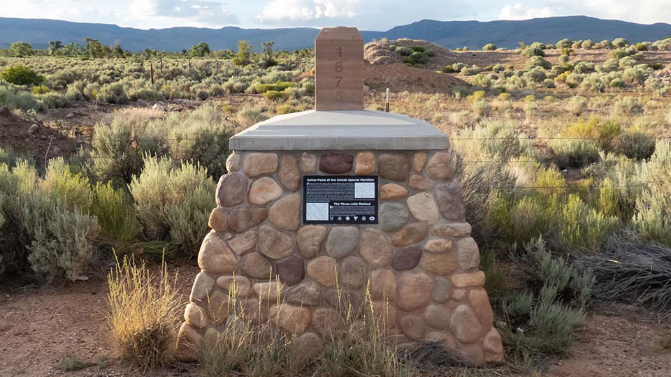
In 1875, Deputy Surveyor Charles L. DuBois of the Government Land Office set the Initial Point of the Uintah Special Meridian to subdivide the Uintah Reservation into townships and sections. The meridian line was to run north and south and a base line east and west from a stone mound placed in the present-day Hayden area.
The Black Hawk War
Still other Utah Utes didn't relocate to the Uintah Reservation. 1865 was the beginning of the Black Hawk War, named for a Ute leader who united Ute, Paiute, Navajo and Apache factions in an uprising against Latter-day Saint settlers. The war, caused by frustration from years of Native starvation, disease and land loss from settlement, plus conflicts over cattle raids, resulted in about 150 skirmishes and raids that killed roughly 70 settlers and far more Native Americans, including around 16 uninvolved Paiutes killed in the 1866 Circleville Massacre.
In 1867, Black Hawk traveled to the Uintah Reservation and asked for peace talks with the superintendent of Indian affairs, though some raids by other bands continued for years after. Black Hawk died of tuberculosis at Spring Lake near Payson in 1870. In 1872, federal troops consolidated control over the Utah Territory and remaining Utes were pushed to the Uintah Reservation.
The Colorado Utes
Other Colorado Utes were later relocated to Utah, joining the Uintahs. In 1879, tension built as Indian Agent Nathan Meeker pushed the White River Utes to abandon their traditional ways for farming. In the midst of a battle with Army reinforcements who'd entered their reservation, a group of White Rivers killed Meeker and his staff and held hostage the surviving women and children. Interior Secretary Carl Schurz drafted a "nonnegotiable agreement" laying out the terms of relocation, which was ratified by congress in 1880, that forced the White River Utes to the Uintah Reservation.
The "agreement" also expelled the uninvolved Southern and Uncompahgre Utes off their Colorado lands. The Southern Ute lands were reduced to a smaller reservation, headquared in Ignacio, on the La Plata River. Additionally, after a federal commission claimed the planned location for the Uncompahgre reservation near the Gunnison and Grand rivers had insufficient farmland, Chester Arthur's 1882 presidential order established the new Ouray Reservation (that remains outside the Uintah Meridian survey boundaries), southeast of the Uintah Reservation. The Bureau of Indian Affairs merged the Ouray and Uintah Agencies in 1886, forming the Uintah and Ouray Agency. Notably, one group of Colorado Ute under Colorow resisted removal to the Utah reservation until 1887.
Allotment and "Surplus" Land
The 1887 Dawes Act encouraged assimilation and the allotment of U.S. reservation lands to individual tribal members in plots of 20 to 160 acres, with unallotted land reverted to the public domain and opened to homesteading. The Indian Appropriations Act of 1902 applied the act to the Uintah Reservation, and tribal land was allotted to Uintah and White River band members in 1905. Any undistributed land, minus trustlands for grazing, was opened to homesteading that same year for $1.25 per acre by Theodore Roosevelt's presidential proclamation.
Uncompahgre land was allotted earlier, hastened by mining interests in the area. Congress allowed mining companies to purchase a 7,000-acre "Gilsonite strip" out of the Ouray Reservation in 1888, then approved allotment of the reservation in 1897. The Uncompahgre opposed the plan, and officials had made no allotments by the time the reservation opened to homesteading April 1, 1898. In May, 83 allotments were finally made. As the land had already entered public domain in the eyes of federal law, Congress confirmed them retroactively in 1899. Ironically, much of the land was too poor for homesteading and went unclaimed.
The Meridian's Lasting Influence
The Indian Reorganization Act of 1934 ended federal allotment policy and the sale of "surplus" land to homesteaders. It also allowed tribes to form elected governments, like the Ute Business Committee, instead of leadership solely by appointed agency superintendents. However, allotments and homesteading had a lasting influence: settlers had encroached on promised reservation land, leaving a checkerboard of tribal, private and state ownership that caused jurisdictional conflicts, while allotments are often left split among too many heirs to be practical (called fractionation).
The importance of the Uintah Special Meridian, aside from being distinct from the Salt Lake Meridian survey that subdivides the rest of Utah, came as the Uinta Basin's tribal allotments, homesteads and townsites (with their lasting influence) were divided using the grid from the 1875 Uintah Meridian survey. That significance endures today, as part of the Public Land Survey System, determining boundaries in parts of Duchesne, Uintah and Wasatch counties.